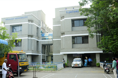
OULGARET MUNICIPALITY
Home
OULGARET MUNICIPALITY DETAILS
GEOGRAPHICAL LOCATIONS
Oulgaret (Uzhavarkarai) Municipality is located at North East of Pondicherry municipal limits. The Oulgaret Commune Panchayat come into existence by a French Metropolitan Decree dated 12-03-1880 and later on 14-01-1994 it was elevated to the status of a Municipality.
MUNICIPAL LIMITS
The total area of Oulgaret Municipality is 36.7Sq.Kms. Population as per 2011 census is 3,00,150. The area is comprised of 8 Revenue Villages.
- Alankuppam
- Kalapet
- Pillaichavady
- Oulgaret
- Karuvadikuppam
- Saram
- Reddiarpalayam
- Thattanchavady
The Municipality is sub-divided into 37 wards as per de-limitation of wards, 1995.

37
Wards

3,00,104
Total Population

1,48,464
Male

1,51,640
Female
SECTIONS OF THE MUNICIPALITY
- General Section (Establishment)
- Accounts Section
- Engineering Section
- Health Section
- Revenue Section
- Birth, Death and Marriages (Etat-Civil) Section
- EDP Section


